Surveying & Mapping

Surveying & Mapping
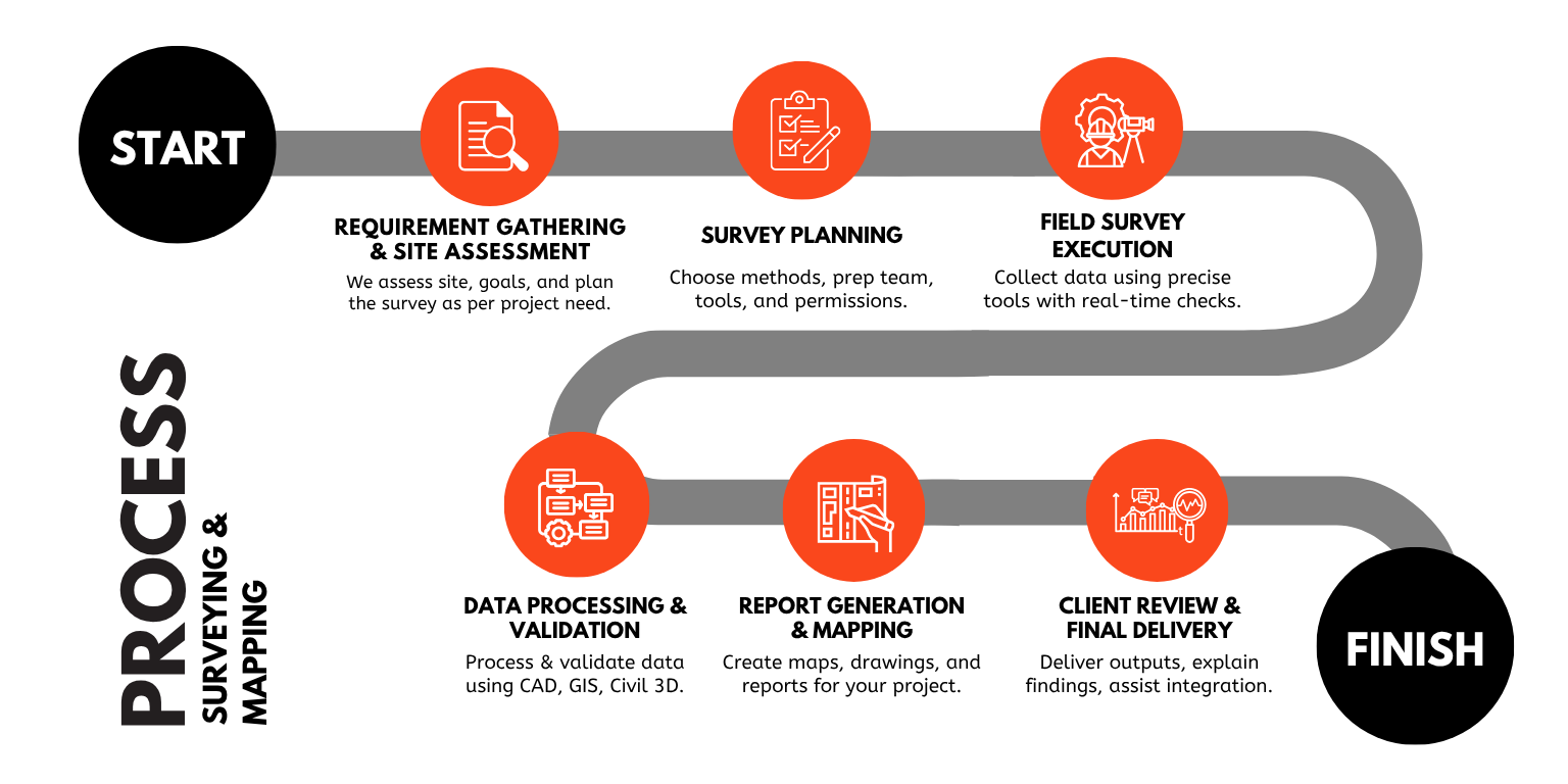
At VB Engineering, our Surveying & Mapping services provide the foundation for every successful infrastructure project. Accurate surveys are the backbone of every successful project. We provide GPS, DGPS, Total Station, Topographic, Bathymetric, and Drone Surveys, as well as specialized surveys for pipelines, canals, and drainage networks. Our precise data enables informed decision-making from concept to completion. These insights support informed decision-making during design, planning, and execution phases.
Services We Offer
Comprehensive land and infrastructure survey solutions using advanced tools. Specialized in topographic, traffic, GPS, and drone surveys for accurate planning.
GPS Survey
DGPS Survey
Total Station Survey
Topographical Survey
Bathymetric Survey
Traffic Survey
Aerial / Drone Survey
Railway Line Survey
Layout Survey
Transmission Line Survey
Canal Survey
Irrigation Survey
Land Survey & Mapping
Water Supply Scheme Survey & Planning
Sewerage Scheme Survey & Planning
Road / Highway Survey
GIS Mapping Infrastructure Modules (City-wise)